Back after a long break of travelling amongst other things.
Christmas was spent with the family and at a New Year’s Eve party with friends and then we flew back to Curacao on 9th January 2023.
“Maya” has been on the land since mid-December in Curacao marina.
We stayed one week at the hotel in Willemstad to pack our trekking gear ready for our seven week trip through Central and Southern Chile and Argentina. This area is, of course, more commonly known as Patagonia – after months of careful planning it was finally time to start our long road trip.
We flew from Curacao via Bogota and Santiago to Puerto Montt. From there we took a cab to Puerto Varas, 30 km away.
In Puerto Varas we stayed 5 days and then we collected our mini camper-van from a company called “Wicked”.
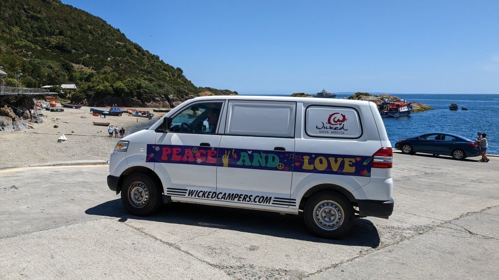
The small town of Puerto Varas is located at the large Lago Llanquihuesee and was founded in the last century by German settlers.
Our route starts in Puerto Varas and leads us through the famous trekking areas of el Chalten, Calafate in Argentina to Torres del Paine Park in Chile and on to Punta Arenas. Finally a trip with a normal car to Tierra del Fuego.
The impressions on this trip could not have been more diverse. Extraordinary and untouched nature with unforgettable experiences.
Great landscapes with ancient flora and creeping glaciers. The dense, impenetrable virgin forests on the Carretera Austral (Ruta 7 and Ruta 40), the southern Beech tree forests, then the 4000 years old and up to 60 meters tall tree giants of the Alerce trees make the flora unmistakable.
This trip is one of the most beautiful and we want to come back.
Since Chile and Argentina we are totally fascinated by the glaciers. We spent hours looking at the impressive “Perito Moreno” glacier, with the unfortunate consequence of an intense sunburn the next day.
One should not underestimate the distances in Chile and Argentina and the “roads” (many of which are just unpaved tracks) are anything but good. The surface can vary from occasionally well paved to long, long stretches of loose stones and rocks dotted with frequent potholes. The latter seeming to dominate.
Similarly the availability of fuel stations needs to be taken into account. Basically every time you see a fuel station it is a good plan to fill up, even if it is just a quarter of a tank.
Early in our trip we ignored a fuel station once as we knew there was another one at our destination. What we didn’t know was that the fuel station that awaited us only stocked diesel and our little van needed petrol.
Luckily a helpful staff member at a nearby thermal pool told us not only where a new fuel station had opened (about 150km away) but also where to get the most excellent salmon dinner!
Anyway, after collecting over our small camper we loaded it with provisions and started our trip on the Carretera Austral to Hornopiren and from there we continued with a double ferry trip (Hornopiren-Leptepu-Caltea-Gonzalo).
Pre-booking some of the ferry tickets is essential as otherwise we would have had to wait 5 days to get a space. We did meet one couple who had travelled at roughly the same time and ended up staying in Hornopiren for a week before there was a space on the ferry.
The ferry ride of several hours gave us our first impressions of the fjords and also of the weather. Cloudy and drizzly but great landscape.
After the first of the double ferry trip we had our first taste of road conditions to come. Gone was the paved but potholed road and we were greeted with a mud and gravel “road”. We could drive only slowly on this road as there were also road works. It was difficult to determine if they were making the road better or worse!
At our first camp there was a hike to a waterfall through lush greenery with giant ferns but in the rain. It was also very cold at night. We were happy to be able to sleep in the van and not like some others in the tent.
The onward journey took us to Puyuhuapi, a small idyllic fishing village where we stayed for several days. We did a great hike to the hanging glacier in the Venstisquero National Park (once again pre-booked tickets were essential) and visited the Termas del Venstiquero.
The weather remained steady rain and only occasionally did the sun come through. But on our hikes we were very lucky and generally had better conditions with even some sun!
During the first few days it became apparent that the van had problems with the rear suspension. On anything other than smooth road surfaces (so pretty much all the time) the rear of the van would bounce around and slide sideways in an alarming fashion. It was like driving on ice! After a couple of days it became more manageable as you could predict what was going to happen.
(John thinks that both the rear shock absorbers were not working any more)
It was a quite jarring experience on the roads with a thousand deep potholes and mud.
The trip to Cohaique followed a caravan of cars travelling at about 30 km/h. At the front a large lorry needed the entire road which in turn snaked up the mountain in a series of sharp left and right turns. The good news was that oncoming traffic was minimal. Grip on the corners was also minimal and some cars had to have several “goes” at getting around. Unbelievable!
We had not expected such road conditions. After 5 hours driving for just 100 kilometres in the continuous rain we arrived in Cohaique at a nice campsite.
The small town is lively and offers everything you need including laundromats. Everywhere we meet very friendly and open Chileans who like to talk to us and offer help and advice.
Onward through Cerro Castillo we continued to Lago General Carrera, a large lake with turquoise water. Here are the “Capillas de Marmol”, a extraordinarily beautiful cave system formed by the erosion of the marble coastline by water. We stayed on the campsite “Pudu” directly on the lake and it was wonderful there. An ice cold swim for me had to happen of course.
We explored the caves from a boat tour and were fascinated by the impressive play of colours from the turquoise blue of the lake and multi-hued veins running through the marble rock.
Impressive Marble Caves
The onward journey took us through the impressive National Park Tamago over the pass “Paso Roballos” to Argentina. But before we went there we filled up the tank again. It is so important to fill up at every fuel station. There are not many of them and, if you are unlucky, they may only have diesel!
The way was a small gravel road that led us up into the mountains through a magnificent landscape. Here we saw Guanacos (a bit like a lama) for the first time. We would see them hundreds of times in the course of our travels and Angelika would take a picture of every single one.
This time we pitched our tent on a fantastic campsite next to a river and close to the Ranger station. This meant hot showers if the resident ranger had lit his/her fire. Luckily the (female) ranger on duty had lit the fire – hot showers for us!
Next day a terrific hike over 18 km led us through the wilderness to a narrow suspension bridge that required some courage to cross. We did not see a Puma but many more guanacos (with pictures to prove it)
The road out of Chile goes through a pass and then the border crossing was great; It consisted of a few wooden building, a huge radio antenna, and three smartly uniformed officials in a small wooden house. They were happy to see us, took photos for us and wished us a good onward journey.
Then there were several kilometres of what must count as no-mans land between the two borders. We don’t know who this belongs to as it’s past the Chilean border, but before the Argentinian border!
Entry into Argentina was through a similar border with smartly dressed border police and manually operated barriers. We felt that the Argentinian staff took this more seriously and were quite officious until the passports and car papers were correctly stamped. Then the one border guard relaxed, just a little, and walked out to open the barrier for us.
These small border crossings standing in the middle of nowhere could also play a backdrop in some John le Carré novel about spies and illicit dealings!
Within a short time the green landscape with snow-capped mountains gave way to a barren desert landscape with steppes, rocks and dusty tracks – Welcome to Argentina!
Argentina is incredibly dry on this side and it became hotter every day.
The dusty Carretera 40 is also here only on a few stretches paved. There are only isolated smaller settlements often only with a fuel station, small supermarket and a few simple houses. The people in Argentina are much poorer than in Chile and the inflation rate is roughly 95%.
The is the official currency the Argentine Peso but US dollars are in huge demand. You can exchange dollars for Argentinian Peso in many supermarkets or shops for up to four times the official exchange rate for US dollars. The government tolerates this unofficial exchange as they are desperate to get US dollars into the country. Euro are also exchanged at good rates, but we never found out as we only had dollars.
The best exchange rate we had was at a Chinese laundry although we had to tell them in advance. Big notes (20’s or 50’s) are better for this “service”.
The superb drive to el Chalten in the National Park los Glaciares was unsurpassed with great views of Cerro Fitz Roy (a 3,406m high granite mountain)
We reached el Chalten in glorious sunshine and spent the night in an official campervan parking lot. Next day we started a three day trekking tour with tent that took us via Laguna Capri to Cerro Fitz Roy and Laguna Torre.
Unique fauna and great views of the mountains and a lagoon full of drifting blue icebergs made this one of the most beautiful trekking tours, even though it was quite exhausting with a backpack. But this unique feeling to spend the night here in the tent and to drink glacier water was unforgettable.
As soon as we reached el Chalten again, the weather turned stormy with much wind and heavy rain, so we continued the next day to the 200 km distant Calafate along the Lago Argentino.
There we stayed one week on a wild camp ground at Lago Roco where we could observe some wildlife like a giant owl, a skunk and several armadillos.
Of course, the obligatory trip to the Perito Moreno glacier including a boat tour on the front of the glacier was not to be missed.
This glacier is so fascinating! In some places it is up to 77m high, the calving front is 2.3 km long and the glacier itself has a length of 33km. A breathtaking sight that will not let you go so quickly.
The following onward journey to Torres del Paine took 2 days again with an unproblematic border crossing back into Chile. In Torres del Paine we stayed for a week at the Pehoe campground, which is quite centrally located at Lago Pehoe in the park.
This spectacular national park and Unesco World Heritage Site is known for its breathtaking landscapes. Impressive mountain ranges framed in what used to be vast ancient forests.
However in some areas of the ancient trees were destroyed by a tourist carelessly burning toilet paper and causing a fire in 2011. Now the trees point into the sky like gnarled primordial creatures.
We took several day hikes and spotted guanacos grazing as well as condors flying high above. We saw foxes and always had great views of the Paine Massif. One hike led us to the Salte Grande a waterfall at the foot of the Paine Massif with views of the Torres del Paine and Lake Nordenskjöld. The weather changed between sunshine, hail and continuous rain and insane wind speeds, which forced us to turn back even on a hike. A part of the “W-trek” to the viewpoint to the glacier Grey took us first with a catamaran over the lago Grey to the Refugio. Unfortunately it was raining cats and dogs,windy and cold. Only later it cleared up and we could enjoy the wonderful view.
Overall, we found the Torres del Paine Park but very crowded with people all walking the “W-trek” or the “O-trek”. You have to book every campsite in advance and spaces in the large refugios are difficult to obtain.
From here we went via Puerto Natales to Fin del Mundo and Punta Arenas.
Punta Arenas is a small bustling city located on the Magellan Strait, which connects the Atlantic Ocean with the Pacific Ocean. The economy is based on the oil business, fishing and tourism. Punta Arenas has one of the highest educational standards in Chile and also a very low unemployment rate.
One feels that this really is the End of the World. The landscape is barren and only sporadically one finds smaller forest areas, which are sparsely populated. The coast is rough and the weather is not much better.
After 2 days of wild camping at the southern end of Punta Arenas, we reluctantly returned our campervan to “Wicked” and rented a regular car for 3 more days to go to Isla Tierra del Fuego.
With the ferry we crossed to Isla Tierra del Fuego at the northernmost end and stayed on a camp-ground on the area of a hostel in Sombrero. They were having a lamb barbecue there in the evening and we got a free sample.
The Chileans here are incredibly hospitable and very happy people.
The next day we drove to the only King Penguin colony that is very strictly monitored and controlled. As it is estimated that there are only 200 pairs left there. We were rather disappointed because of the 200 pairs maybe 30 were on site and we could only observe them from quite a distance.
The landscape on Isla Tierra del Fuego is rather barren and flat and there is usually a strong wind blowing. We drove to the small town of Cameron and stayed one last night in the tent. This night was also the coldest and most uncomfortable night with minus temperatures and hail and snow mix.
We had initially set the tent up next to a wooden shelter that is provided for sitting and eating. A sudden storm with strong winds and snow made us move the tent into the shelter where there was just enough space.
For the last night on the island we rented a room in the only hostel of Sombrero. It was just great to have a warm room and warm showers with a great delicious traditional food (Pastel del Choclo) in the evening.
After 2 days in Punta Arenas we started our flight back to Santiago via Puerto Montt. In Santiago we visited a winery, which was close to the airport, before we finally went back to Curacao via Bogota.
We liked Patagonia enormously on the Chilean as well as on the Argentinean side. This unique fauna, wilderness with a mixture of loneliness and always helpful people are enough reasons to come back. This is the uninhabited vastness of southern Argentina and Chile.
Where on our small globe can you find that today?
One thing that stood out during the whole trip were the number of cyclists we passed pedalling into the persistent wind and rain. As previously mentioned, the roads were horrendous to drive and so what they were like with a bike we can only guess at.
They must have their own guidebooks as they seemed to stay wherever there was an abandoned restaurant or similar buildings – we seldom met them on the campsites.
One night we stayed next to an abandoned cafe one evening and in the morning we explored it and found a lot of cyclist graffiti on the walls – these few pictures just about sum it up.
The cyclists certainly earned our respect and we felt guilty that we couldn’t help them more often when they were battling against a 30 knot headwind. Take a look at some of the mileages they have written in the pictures – we checked – they are accurate!
